Denmark’s infrastructure manager Banedanmark has awarded Fugro a four-year framework agreement for train-borne LiDAR (Light Detecting And Ranging) scanning of its infrastructure using its award-winning RILA system for quick and accurate digital surveys.
Banedanmark manages Denmark’s public railway infrastructure and is responsible for maintenance, traffic control and development of most of the Danish railway network, covering over 3,000km of track. Its priority is to keep the railway efficient, safe and on time, which requires accurate information on the track and any objects in the rail corridor.
Fugro’s unique RILA train-borne survey technology will be used both to acquire LiDAR data and imagery of the track and surrounding environment to create a highly accurate, information-rich model of Denmark’s railway infrastructure. This so-called ‘digital twin’ will enable Banedanmark to detect any objects in conflict with its railway infrastructure clearance profile and perform clearance gauge mapping, essential for the safe operation of the network.

There are two elements to Fugro’s RILA system. RILA Track measures absolute track position and geometry to engineering-specification accuracy, incorporating georeferenced video to record track assets. It is unique in being the only track measurement system able to connect to any passenger train and measure at line speed – up to 200km/h (120mph) – without the need to alter or affect the train’s normal operating performance.

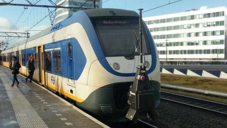
While the RILA Track system focuses on the track, the RILA 360 system incorporates twin 360° laser scanners and a panoramic imaging system to supply ultra-high density LiDAR point cloud data of the entire route. Each laser scanner rotates at 200Hz, recording one million points per second. The RILA 360 system can be mounted to any service train that is fitted with buffers and scans the complete rail corridor, including track assets, structures, earthworks and vegetation.
Although the RILA systems work independently, they can be combined to produce a highly accurate georeferenced or geopositioned point cloud, enabling detailed and precise planimetric feature extraction.

Fugro global rail director Jeroen Huiskamp said: “This is the first time that Banedanmark has used train-borne LiDAR technology on large extents of the network and we are proud that they have chosen our RILA solution.
“The operational flexibility, improved safety levels, highly accurate data and attractive costing set it apart from other survey methods. “
Previously, Banedanmark network infrastructure surveys used traditional terrestrial methods, so acquiring LiDAR data via a mobile platform will dramatically reduce the need for on-track surveyors and provide accelerated data capture.

Banedanmark’s project manager Charlotte Lomholt was enthusiastic. “We look forward to an ongoing cooperation with Fugro to survey the Danish rail network,” she said. “With 190 million passengers and 3,000 trains passing through Denmark, safety is a major driver.
“The data that Fugro delivers will enable our teams to supervise the structure gauge and improve infrastructure maintenance predictions. All in all, it will help create the railway of the future.”
Data collection will begin in autumn 2019, followed by a full network capture from 2020 onwards.

The resulting datasets will be imported into Banedanmark’s existing software and made available via Fugro’s web-based RILA Portal. This provides a single point of truth (SPOT) dataset from which users can view and download data, inspect and analyse assets, and share and extract value from asset data more efficiently than ever before.
The data will benefit many of Banedanmark’s business activities, including track maintenance, asset management, landscaping, and detailed design by the construction and signalling divisions.


Be the first to comment